


Sundarbans the forest that protects, feeds and sustains

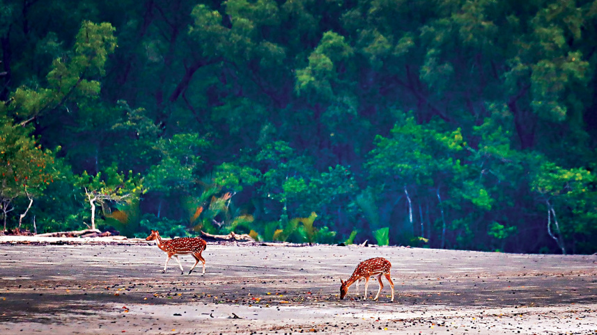
The first thing one notices at dawn in the Sundarbans is not the green forest cover, the muddy riverbank or the waves breaking on the shore.
It is the silence, an eerie one.

On such a dawn recently, days after the forest reopened to tourists and fishermen following a three-month closure, our boat moved slowly through a winding waterway. A thin veil of mist hung among the trees along the riverbank, their reflections moving gently with the water.
There were no tourist launches or crowds nearby. Only the distant calls of birds briefly broke the silence.
In that stillness, the Sundarbans revealed the beauty of the forest in all its glory.
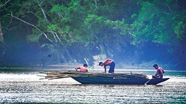
But the longer one watches, the harder it becomes to think of the Sundarbans merely as a forest.
It is a vast living system, with mangroves protecting the coastline, roots holding sediment, creeks nurturing aquatic life, soil and vegetation storing carbon, waterways sustaining wildlife, and thousands of families along the forest’s edge depending on it for their livelihoods.
The Bangladesh part of the Sundarbans spans 6,017 square kilometres, comprising roughly 4,143 square kilometres of land and 1,874 square kilometres of water.
It is one of the world’s most remarkable hubs of biodiversity.
According to Forest Department data, the Sundarbans is home to about 210 fish species, 528 plant species, 355 species of birds, 87 species of reptiles and 505 other wildlife species.
The Bengal tiger is its most celebrated inhabitant, alongside spotted deer, crocodiles, dolphins and wild boars.
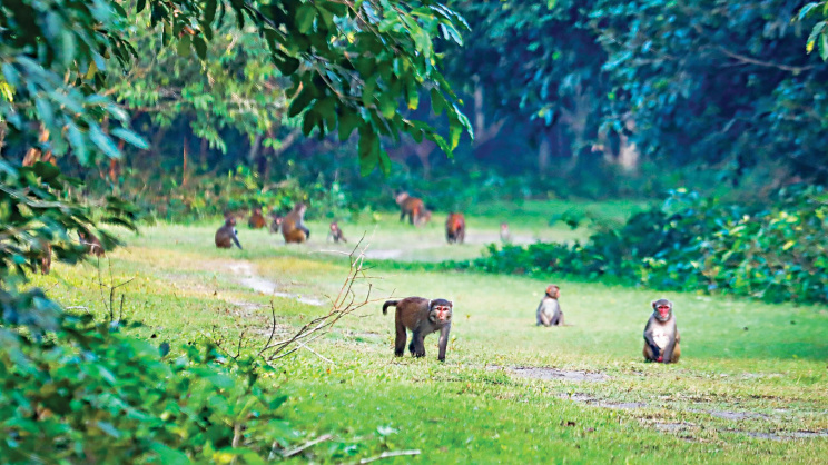
Together, the trees, water, soil, plants, animals and microorganisms form a vast living network. If one part of that chain is broken, the consequences can extend far beyond it.
Perhaps the Sundarbans’ true significance becomes clearest when the weather turns violent.
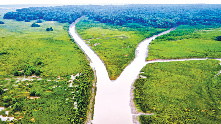
Standing between the Bay of Bengal and the vulnerable southwestern coast, the forest, with its dense vegetation, tangled roots, creeks, mudflats and wetlands, acts as a natural buffer against cyclones and storm surges. It absorbs part of their energy and slows waves and tidal water before they reach settlements farther inland.
Over the past decades, the Sundarbans has stood as a shield against powerful cyclones, including Sidr, Aila, Roanu, Fani, Bulbul, Amphan, Yaas and Remal.
According to a study of Cyclone Sidr in 2007, the Sundarbans prevented damages worth around US$ 543 million.
Much of the forest’s wealth, however, lies beneath the surface.
Its vast and constantly changing aquatic landscape, comprising rivers, creeks, tidal channels, mudflats and wetlands, provides feeding, breeding and nursery grounds for fish, shrimp and other marine organisms.
For local fishing communities, the ecosystem is a source of livelihood.
“I have been fishing in the Sundarbans for past 45 years and earning a livelihood for my six family members. The forest is like a mother who feeds me,” said Shibapada Biswas of Khalashibunia village under Khulna’s Batiaghata upazila.
 For all latest news, follow The Daily Star's Google News channel.
 Like Shibapada, more than 12,000 fishermen are engaged in fishing in the Sundarbans.
The connection extends farther. The Sundarbans is linked to estuaries, rivers and the Bay of Bengal through a complex network of tidal flows, sustaining marine resources that eventually reach markets and households.
The health of the forest ecosystem therefore has a significant bearing on the coastal economy.
Communities surrounding the Sundarbans have depended on its resources for generations. People travel deep into the forest seasonally to collect honey, beeswax, golpata and other forest products under regulated systems.

These activities form part of a coastal economy worth around US$ 145 million annually, according to a recent study.
The forest ecosystem also absorbs and stores large amounts of carbon.
Research estimates the forest’s annual value of carbon sequestration at around US$ 3,600 per hectare.
Yet such estimates capture only part of its value. The Sundarbans simultaneously sustains lives and livelihoods, protects against disasters, and contributes to climate change mitigation and adaptation.
Its future, however, depends heavily on freshwater, one of the key elements maintaining its ecological balance.
Rainfall and freshwater inflow influence coastal salinity. During the monsoon, increased rainfall and river discharge can reduce salinity, while the dry season intensifies it.
A 2025 study analysing long-term data found changes in freshwater flow from the Ganges system and linked them with changing salinity patterns in the Sundarbans.
Experts have warned against upstream water management and projects that could alter freshwater flows to the forest.
Expansion of shrimp farming in surrounding areas also disrupts natural water flows and increases salinity.
Professor Nabiul Islam Khan of Khulna University’s Forestry and Wood Technology department stressed the need for proper environmental impact assessments before major projects that could alter freshwater flows.
He also called for research to guide future sustainable management and afforestation programmes, and for implementation of the 1998 government ban on cutting small trees in the Sundarbans.
He warned that further reduction in freshwater availability could increase salinity and put additional pressure on valuable tree species such as Sundari.
The Sundari is one of the defining mangrove species of the forest. For decades, scientists have observed a phenomenon in which the upper parts of affected Sundari trees gradually die.
Increasing salinity, freshwater scarcity, sea-level rise and other environmental pressures have been associated with the decline of Sundari in parts of the forest.
One estimate put the annual loss in Sundari timber value at about US$ 16.7 million.
But the impact goes beyond timber value. A dying tree stores less carbon, holds less soil, provides less canopy and can signal wider ecological decline.
Researchers have also raised concerns about the condition of the forest soil.
A recent study found excess phosphorus build-up in the soil that can disturb nutrient balance, interfere with root functions, weaken vegetation and potentially increase vulnerability during extreme weather.
The recent three-month closure also offered a reminder that tourism in the forest itself must be carefully managed.
During the 2024-25 fiscal year, about 3,28,017 people visited the forest, according to Forest Department data.
Experts warn that tourism can leave an irreversible footprint on the forest ecosystem.
A recent study titled “Ecological Monitoring of Sundarbans”, conducted by CE GIS under the Sundarbans Protection Project, found that the forest’s condition is not uniform.
Around two-thirds of the Sundarbans had moderate ecological health, neither good nor poor. The remaining one-third showed deterioration in soil and vegetation health.
These ecological pressures do not operate separately.
A change in water can alter soil conditions, which can affect vegetation. Changes in vegetation can influence habitat, while habitat changes can affect wildlife and aquatic life.
For scientists and forest managers, continuous monitoring is therefore essential to understand where and why the forest is changing, and how it can be managed and restored effectively.
The Sundarbans, after all, is one interconnected system.
Comments